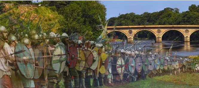
Border Story - battles and bridges
Campfield
Carham
Donaldson’s Lodge - place & community
Families from Donaldson's Lodge
- Renton, Swan, Moffat, Green
- Swan, Renton, Black, Green
St. Cuthbert’s Chapel and Railway bridge
Branxton
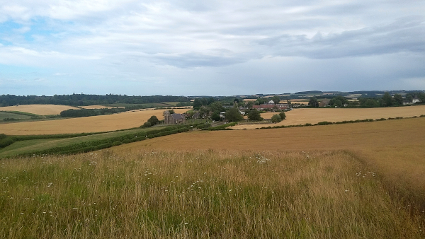
View NE over Branxton
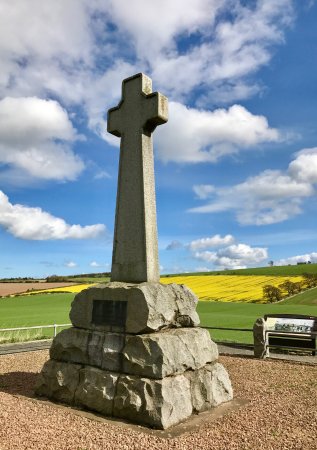
Flodden memorial
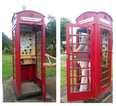
The smallest Tourist Information Centre
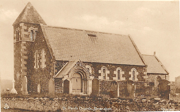
Branxton Church date?
Border Story - Battles and Bridges
Border Story click here for the flyer
Campfield
Most of the following information is from the informative and well-researched book ‘A History of Campfield, Cornhill-on-Tweed’ by Graham Dennis. Extracts have been used with his permission.1715 During the last 300 years, historical references have mentioned a mineral spring in, what is now, Campfield. It is probable that the spring would have always been regarded as having medicinal properties and would have been visited since very early times. One of the earliest known references was in 1715.
1750s By now interest in the spring/well was established and it features in all the major histories for nearly 100 years. It was known as a chalybeate spring, i.e. waters rich in iron salts.
1752 The church of St. Helen was rebuilt on the site of an earlier church in 1752, at the height of the spring's popularity. In records, the spring has been referred to as St. Helen’s Well and even St. Cuthbert’s Well.
1769 First reference to a permanent structure, a cold bath for bathing built near the spring was made in 1769. The spring, of the highest medical fame and most frequented, was described as being between Learmouth and Cornhill and was commonly called Cornhill Well. The bathing pool was paid for by Henry Collingwood. It was ‘neat and cased with lead and emptied by turning a cock’.
Also in 1769, a map of Northumberland was published. Campfield is shown as Camp Hill. The bath and the spa are marked on this map. (The map is reproduced in Graham Dennis’ book.) It seems that the bath house was in use for nearly 100 years.
1813 The impression is given in accounts that the spring and bath were beginning to fall out of favour, maybe because Cornhill’s remote location made it less popular as other more accessible resorts flourished.
1852 It was stated by James Raine that the well ‘now wastes its healing powers and the bath is destroyed’. Hereafter, the healing waters of Cornhill begin to fade from memory with only the occasional mention. In writing this in 2020, there is no recollection amongst local people of the existence of a bathing well in Bathing Well woods, even though the name persists.
1867 Reported in ‘History of the Berwickshire Naturalists’ Club’, article written by Rev.S.A. Fyler on the Village of Cornhill
“In the middle of a wood . . . is a very cold and pure spring, whose waters are reported to be beneficial in the scurvey and gravel (kidney stones). There used be a bath house there, now destroyed.”
On the modern Ordnance Survey maps a well is marked in the wood at grid reference NT 858387. The spring flows into the Duddo Burn and the public footpath from the Duddo bridge to the lane to Campfield is known as Bathing Well path. Apparently young people used to meet in the area by the Duddo bridge.
Another well can be seen on the east side of the steep hill of the B6350 Wark road near where it joins the main A698 in Cornhill. The stonework here dates from 1842. Locals sometimes refer to this as St. Helen’s Well too.
If you have more information about this, please send it to us
The following extract referring to Campfield, is taken from 'A Tour of Scotland and Voyage to the Hebrides' by Thomas Pennant, 1772
“Terraces - Observe on the right several very regular terraces cut on the face of a hill. They are most exactly formed, a little raised in the middle, like a fine walk, and about twenty feet broad, and of a very considerable length. In some places were three, in other five flights, placed one above the other, terminating exactly in a line at each end, and most precisely finished. I am told, that such tiers of terraces are not uncommon in these parts, where they are called baulks. Mr. Wallis conjectures them to be places for the militia to arrange themselves on in time of war, that they might shew themselves to advantage thus places rank above rank. Mr. Garden describes several which he saw in Scotland, which he conjectures to have been Roman and formed for itinerary encampments; in my opinion a less satisfactory account. It appears more reasonable that they were designed for what Mr. Wallis imagines, as nothing could more highly gratify the pride of a chieftain’s heart, in this warlike country. than to review at one glance, his vassals placed so advantageusly for that purpose.”
Carham
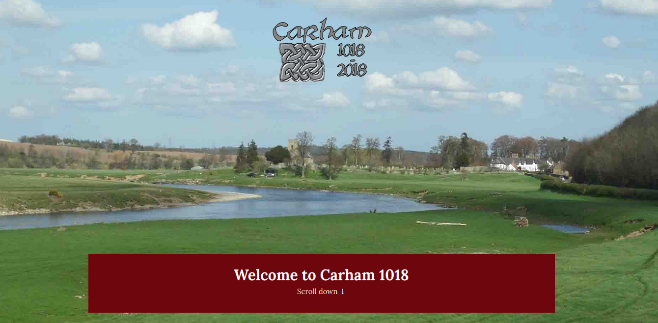
Carham 1018 - link to the website
Donaldson’s Lodge
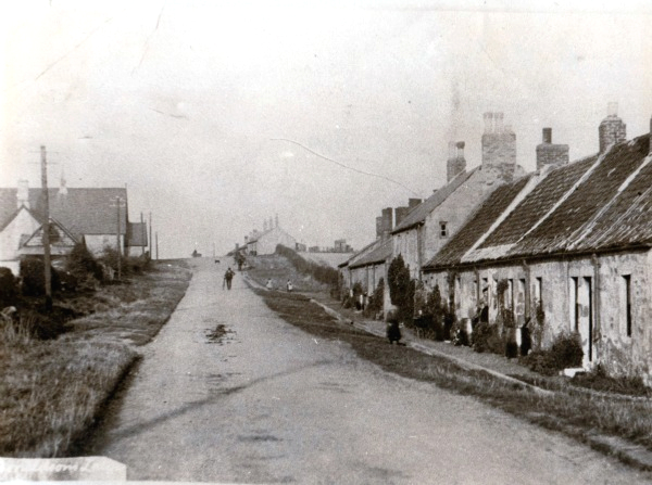
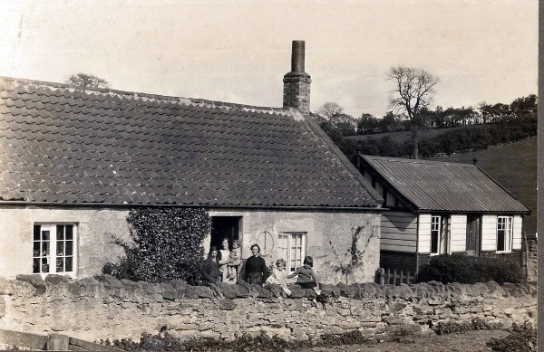
Donaldson’s Lodge, 1907 (unsure of date)
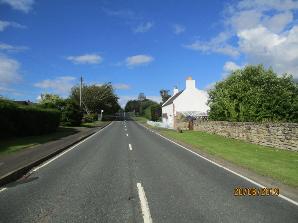
Similar view taken on 20th June 2019
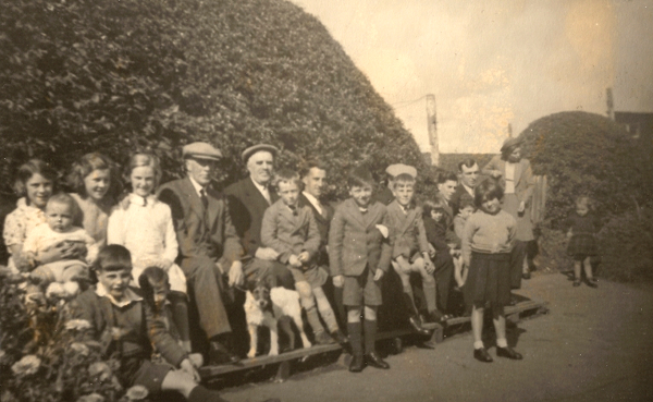
The community, 1907 (unsure of date)
Brethren House
St. Cuthbert’s
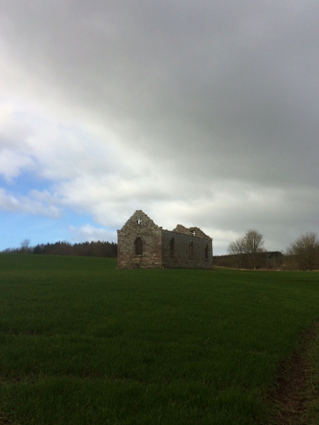
The Chapel
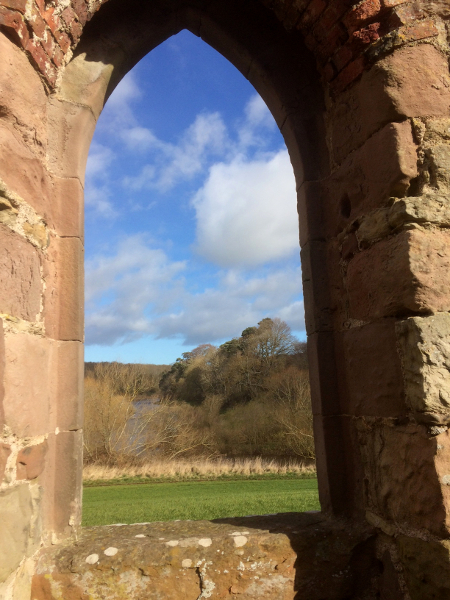
St. Cuthbert's Chapel and View over the Tweed from inside
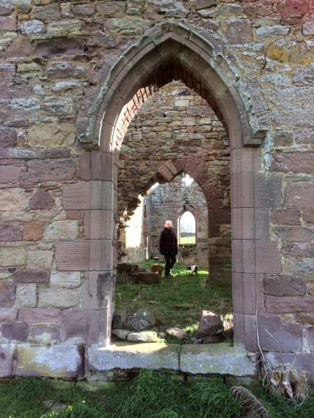
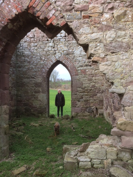
St. Cuthbert's Chapel with Liz Allen and dog, Digby
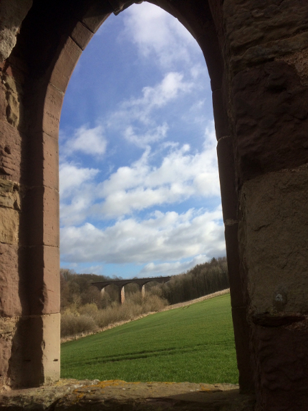
View to the viaduct over the Till
St. Cuthbert’s railway bridge
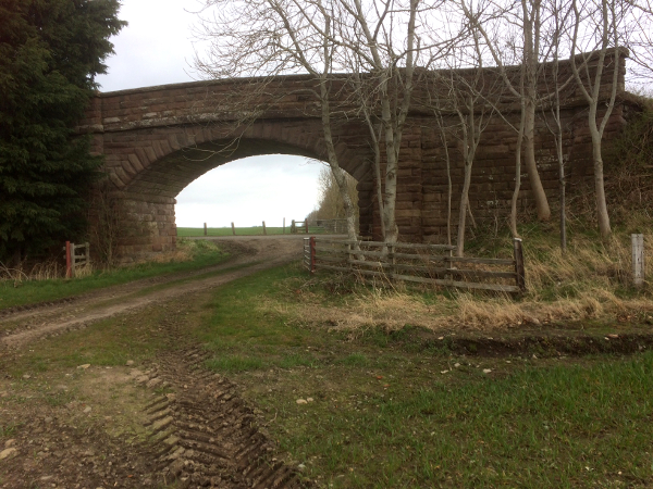
St. Cuthbert’s railway bridge

St. Cuthbert’s railway bridge